Discovered in the WordPress Attic of drafts…The Forgotten Post! Entitled: “Playing Catch UP…”

I hadn’t posted to my Prague post in a long time because, well, i’m not there.  I want to be, but I’m not.  It’s possible I will be again [stay tuned 😉 ].  Anyway, the other week the famous John Lennon wall in Prague made the news because allegedly some art students wanted to commemorate the anniversary of the Velvet Revolution by painting it over as a statement [boneheads] …I wrote about the wall awhile back: https://wordpress.com/post/38420526/375/

So I got a message from a guy by the name of Kurt [Yo Kurt, whaddup?!] at a hip community radio station in New Jersey [ What exit?] WFMU and he wanted to use the picture I took of the Wall for their fundraising efforts.  The answer was and is YES, of course, and that brought me back to take a look at some of my posts.

I discovered in my “blog attic” that I had a couple of posts that I wrote and didn’t post…actually the one I am putting up now was up briefly but there was a protest from a lady friend who I was seeing at the time.  She didn’t like that I noticed Czech women.

If you are a man and have a pulse you notice Czech women.  They have style and panache.  If you go to Paris you notice French women.  Ibid.

The ONE thing that really stood out for me was how these stylish Czech women could walk around Prague in high heels…on cobblestone…all year round.  Could I do it or any guy I know?–I DON”T THINK SO!  Thus the post–a homage to Czech women and their skills and style.  It is remarkable.

Blow the dust off the post, here ya go:

The last few weeks in Prague were a blur…a combination of getting ready to head home to the States and a concerted effort by my Expat friends to make sure I remembered my time in Prague with them. They were successful. I am back in Alaska and will be heading back east to New England in a few weeks to start my next chapter. I’ll be catching up on some posts from my time in Prague as well as documenting my time driving the Alaska-Canada [ALCAN] highway back east as an epilogue for this blog.

Flying back to Alaska, if the weather is clear, is always an amazing sight.
IMG_0695Looking out the window of the plane it struck me that to navigate such treacherous terrain must take incredible skill. This prompted me to think if I was stranded on Denali Denali_Mt_McKinleyWho would I want to rescue me? Who would YOU want to rescue you?

QUIZ TIME!

OPTION A.
3196261-mountain-climber-coming-up-snowy-mountain-smilingGeared out Mountain Rescue Guy who probably read all the Sargent Rock comic books he could get his hands on as a kid, attends every Wilderness Rescue program and training there is, and has a name like “Lance”, “Tor”, or [you fill in the blank-you know what i’m going for…]. OR;

OPTION B.

03681388a Czech woman in high heels.

The correct answer is, of course, OPTION B.

The one thing I immediately noticed living amongst the cobblestone streets of Prague prague_POD1is that Czech women have the amazing talent and gift of being able to navigate like Mountain Goats over cobblestone http-inlinethumb30.webshots.com-42909-2797380290105101600S600x600Q85on the streets and sidewalks in boots that have impossibly high heels andNatalia-25-Black-Womens-Designer1.) not break their ankles; 2.) look stunningly fabulous; 3.) Sashay themselves along cobblestone effortlessly whilst I, in my regular shoes, am constantly twisting my ankle and observing that most males in Prague have a tendency to walk into buildings and lampposts whenever a czech woman walks by in her heels. So clearly Option B is the best as she would be able to scamper up the mountainside and throw you over her shoulder and take you to safety long before Mr. Mountain Man is strapping on his carabiners and setting his pitons…plus she most likely has lip balm which you’ll probably need… Mystery solved!

You’re welcome.

Postcards from The Road. Montreal to New Hampshire. End of the Road. Day 11

ras_03272013The long journey is over.  11 days over 4,505 miles [7,250 Kilometers].  I arrived on Thursday, July 11th and today is Sunday, July 14th…only now am I starting to feel “normal”.  It was a long grueling marathon.

The only fly in the ointment on the last day was the GPS Garmin “Brain Fart”….going through Montreal it had me exit off the highway and route me through a residential neighborhood with a stop sign every few feet…twenty minutes later I was put back on the same highway.  WTF!!!!!  Bizarre…

Maybe I’ll write some more later but for now I need to just snuggle my children


Postcards from the Road. Cochrane, Ontario to Mont-Tremblant, Quebec. WORST DAY EVER. Day 10.

Worst and longest day of the trip…Left Cochrane at 0615 in the rain and it rained off and on the entire 9 and 1/2 hours.  There were some breaks in the rain and sometimes it was torrential downpours…not a relaxing way to drive.  But that’s not why it really was the worst day.

Background….I’ve lived in Maine for over 30 years and have made numerous trips to Quebec Province and Quebec City.  I love how the Québécois cherish and embrace their Francophil roots and celebrate their French heritage.  For those that do not know, French is the primary language of Quebec and in the countryside sometimes its hard to find someone who can speak English.  This French culture has a terrific upside in that the restaurants that I have gone to in Quebec City have amazing French cuisine and a very European attitude towards dining–the table is your for the night, take your time, savor the food and the wine, enjoy your company, live life like it as meant to be lived.  I love my Quebecois neighbors and friends [plus it’s the only place in the world where being a relative of Benedict Arnold is a serious plus…]

Let me tell what I did learn today as I traversed the Province of Quebec.  Quebec drivers are THE WORST DRIVERS IN THE WORLD.  I’ve driven Boston, New York, Philly, all over the US. In Canada I just drove through the Yukon, British Columbia, Alberta, Saskatchewan, Ontario, and now Quebec…OH MY GOD.  What is wrong with you all here?  You take first prize for WORST DRIVERS EVER!

l_first-place-blue-ribbon

You may think I am exaggerating…well try this on. First, I drove the speed limit the entire way [maybe a kilometer or more over].  I’m a guest in Canada and I play by Canadian rules…. plus I don’t want to get hauled off to jail/magistrate or however they handle rural speeding tickets.  I never passed anyone.  Everyone passed me and not by a little but by a lot.

Even elderly “blue hairs” blew by my…I think I saw one Granny mouth to me “slap it on the ass sonny!” as she ripped by me at least 20 miles an hour over the limit.

grannyFinger

Trucks got their grill right up to my bumper.  In my passenger side mirror that says, “objects in the mirror are nearer than appear” I could see the eyeballs of a dragonfly caught in the Peterbuilt grill.  These guys were over the top aggressive.

On numerous occasions cars came up and passed me, and multiple other cars in front of me, in the rain, on a hill, in a “No Pass” area. This was not an isolated incident.  This was Darwin Award material.  Never in my years of driving have I witnessed such boneheaded driving and it was an epidemic.

So, Surete du Quebec [State Troopers for Quebec] I have an idea for you and for your budget, which by listening to Public Radio Canada for 10 days I think I have a grip on the issues you face.  Pick two random days in July and set up speed traps like we do in the US [not saying it’s better, just go with me here].  Only pick people going 10 kilometers over the limit and just pick people with Quebec plates so visitors don’t feel like they’re being picked on like we do here in the States [see, it’s already a better model].  I’ve seen the signs with your “fine” structure…you should make your annual budget in two weekends at the most.  Write this down…your drivers SUCK…maybe its just everyone west of Montreal…dunno…

So for those reading yesterday’s blog you know I wrestled the Road Nuts/Queer devil into a mental compartment to keep it from raising its ugly head.  I could hear it thumping around desperately trying to get out but I had it contained!  I had this! No worries!

For one second let’s go back to the French language thing…it’s a matter of pride and I support the Québécois people!  In Ontario, which has a sizable Francophone population, the signs would be in English with French below that.  I learned some French!  Thank you Ontario for being sensitive and respectful…

Hit the Quebec line and all signs in French, as I expected, but now with no English in smaller letters below.  So my Québécois friends will be upset with me but… REALLY? Take the chip off the shoulder and help the rest of us who are not part of the great debate in Canada over Franco or Anglo navigate your incredibly beautiful country…this actually has a major impact on our experience in your wonderful country…and here ya go…

Leaving the Val D’Or area I noticed some signs in French that I couldn’t read and then a smaller one that said something about “Route Isolee”…hmm…wonder what that means…sounds like isolated…wonder what an isolated route is…

On a 1/2 tank of gas and now about 60 Kilometers beyond that sign it became very apparent to me that I was seriously in “The Bush”.  No houses, no signs, no nothing…and then it struck me–I’m on a two-lane highway with no services for a very long and unknown time….I did remember seeing a sign that said something like “gas 72 kilometers” [it was closed].

I’ve been through upper Ontario in “The Bush” and they had services and now I’m heading toward major population centers so “The Bush”? Yea, I know “The Bush” and this must be some easterners idea of “The Bush”.  Well how bad could this be? C’mon!

I’LL TELL YOU HOW BAD IT CAN BE!

No signs telling you anything like Gas in 100 miles, whatever signs were up were in French only [my Francophil friends you have put an ally in harms way…not happy right now]…so now the bag full of Road Nuts/Queer…

going-crazy-1…springs open like a freaky Jack-in-the-Box.

cartoon-of-jack-in-the-box-isolated-clipart-83383935

I’m now down below a quarter of a tank, the empty tank light is about to come on and I am  making peace with God that I will run out of gas on a far-from-anywhere stretch of road and eventually I will:

1.) Either flag someone down who can alert the police and eventually get back to civilization [oh by the way…its so deserted that every 10 kilometers there is an SOS phone…comforting…] or;

2.) They will find my bear-mauled body cached under a fallen tree [bears cache what they kill to come back an nosh on it later] and at least my kids will have a toe to bury at my memorial service.

I vacillated between acceptance of inner peace and bargaining with God still.  At this time I also have 9 yards of leather seat fabric clenched between my butt cheeks from being Road Nuts/Queer…and by the way the difference between leather seats and fabric seats and the ability to clench leather demonstrates some mad skills here….Thinking I should try out for the “Rebels With Claws” once I get back [ref. yesterday’s post].

Taking all fuel-efficient measures I am squeezing mileage out of the car…love those downhill runs…when suddenly with no warning at the bottom of a hill on a curve is an Esso [Exxon to the US folk] station…no warning, no signs like 10 kilometers or miles or anything earlier…BOOM!

The joy erupting in my car put to shame the Apollo moon landing scene in Houston…and all was well and the Road Nuts/Queer devil was slammed back into his compartment.

11celebration_540x351

Pulling into Mont-Tremblant was an exercise in restraint as all I wanted to do as get this lousy day over with…and it is…phew…that really sucked…

Tomorrow..the States and back in New England…the journey will be over…

UPDATE!…Mont-Tremblant just got hit with a major thunderstorm and the power is out…hotel is on emergency power [thus yours truly] but that also means all the restaurants are out…shout out to Kathy and RPK for my emergency food kits and thank you Yukon Brewery for the beers that ALMOST made it back to the States…peanut butter and jelly with Genoa Salami…hhhmmm…that’s good eatin [in a blacked out room with no other options]….did I mention this was THE WORST DAY?

Postcards from the Road. Thunder Bay to Cochrane, Ontario. Into the bush. Day 9.

The northern route.  Looking at a map it appeared that towns/villages were few and far between which ratcheted up concern about car issues and gas.  The maps showed a lot of woodland and not much else.

The first 150 miles out of Thunder Bay and into the woods confirmed my concerns…no one was around and very few trucks and cars.  The small “wide spots” in the road passing as a village invariably had a gas station with a “No Gas” sign on the pumps…oh boy…it was the Great North Woods…Ojibway and Cree country…the land of ancient canoe routes.

To fast forward I have arrived Cochrane, Ontario on schedule safe and sound and more about Cochrane and other stuff later but first…a confession…ooohhhh/aaahhhh…

The last two days of nonstop worrying brought to the surface a self-revelation…I was going “Road crazy”.  In Maine when someone has been living in the woods for a while and they become a little “off” we called that going “Woods Queer”. Nothing to with sexuality, only their mental state. I was going “Road Queer” [** please feel free to offer your term…I’ve got “DIP”-Driving Induced Psychosis offered up already].  In my hyper-vigilant state of staying on top of possible developing mechanical or environment/situational awareness issues my radar was on hyper drive and I was slowly going wacky.

going-crazy_o_1338687

I spent my young adulthood driving between Philadelphia [home] and Maine [summer camp and college] multiple times a year.  Eight or Nine hours I was used to.  What I wasn’t used to is doing that drive EVERY DAY FOR NINE DAYS now by myself.

Every shake of the wheel must be an alignment or balance problem or were the lugs loosening? Remember that time on the New Jersey Turnpike when your wheel blew between two trucks and you almost got smooshed!  NO-everything was fine…

Was that smoke coming out from the hood?!-Remember that time your Saab engine blew on 495 in Massachusetts! NO, it was the shimmer of light through the smushed bugs on the windshield.

Did that temperature needle move?-NO…

Is that a moose up ahead coming out onto the road?! – NO, it’s a barrel…damn…

And with the realization I was going “Road Nuts/Queer” I laughed at myself, cranked up the music even louder, rolled down the windows and relaxed.  Going Road Nuts/Queer is real…  I’ve been in a car by myself for 8-9 hours a day but today I was  singing along with my tunes at the top of my lungs-which by the way I am THE BEST singer within 100 mile radius of wherever I am…now no one was usually in that radius so it isn’t exactly cut throat competition here…but I have been killing it along with my in-seat dance moves which are killer.  Lots of conversations with myself and I found I started ignoring myself like my kids do when I talk to them…They don’t think my dance moves are much either but the fact is “Dad” does have the moves and they’re just jealous…like how I can talk hip…all I get are eyerolls…jeesh…kids…

Anyway, back to driving the Northern Route here in Ontario…The roads had lots of straightaways and the landscape looked more like the western sub-arctic landscape coming out of Alaska, except with the mountain ranges on either side.  Wildflowers of daisies, Indian Paint brush, and wood lilies lined the road and once when I stopped the smell from the flowers was delicious.

So in addition to realizing I was going Road Nuts/Queer it turned out that after 150 miles there were lots of good-sized towns along the way with full services…Walmarts, McDonald’s, all the signs of franchised western civilization.  I spend a lot of time worrying about things I don’t need to worry about…story of my life and lessons learned all the time on this issue.

So Cochrane…They are all about their Polar bears….huh?  well Cochrane is straight down from the southern tip of the Hudson Bay:

ON_2000499and they run the Polar Bear Express train out of Cochrane.  Polar Bear statues everywhere and it’s their money maker…

IMG_1579and they have their own Polar Bear at some sort of Heritage Park…cool…and apparently your kids can swim with the POLAR BEAR…

IMG_1582What I know about Polar Bears is that they would rather hunt humans than to work an ice hole for an ice seal [what an Ice hole!].  In Alaska you do not mess with them, they will stalk you…you are yummy…so here I am in Cochrane with “kiddie” activity for your children to swim with a Polar Bear…I think there are also other activities like, “Can you put your finger in the electrical socket?!” and “Play time with Dad’s power saw!”…oh good one Wendy you took little Timmy’s leg right off! nice!

And apparently the women of Cochrane know how to have a good time per this flyer up at the restaurants and gas stations…

IMG_1580

Nothing like “Rebels with Claws” male strippers at the Curling Club…are they like lobster strippers or something? Rebels with Claws?

…and you think I’ve gone off the deep end…

Lastly, after 9 days of driving through mountains, sub arctic wilderness, Prairie, and Northern forests, and despite torrential downpours that cleaned my car off a bit I still have what can only be considered a House of Horrors to every flying insect along my way…

My car…the new horror…Coming to a Road near you!

the-brain-eaters-1I present to you, in all its white base paint glory to highlight the carnage [by the way, the white paint job–that’s called Arctic Camo…fyi…]

IMG_1578and I rest my case for the Road Nuts/Queer issue…

Tomorrow Mont-Tremblant, Quebec and then HOME to New England on Thursday!!!


Postcards from the Road. Winnipeg, Manitoba to Thunder Bay, Ontario. Day 8

As expected the change came fast.   On the road by 6:15 am and the sun was just showing the top of its head across the prairie.  Morning ground fog veiled the prairie as it burned off.  The slow creaking sounds of iron on iron was the backdrop to the stillness of the morning as my Motel abutted the Winnipeg train yard…trains were hooking up and starting their move for the day.

Arrow straight road across the prairie and then what seemed like a buffer of 20 miles the forests grew and closed in along the road.  The road started undulating and cut through rock outcroppings.  I was off the Plains, thankfully. Forest and un-countable lakes took over the landscape and for me it was a familiar landscape that was comforting and known.  Deer were plentiful, grazing along the road and the highway signs warned of Moose and for campers to be “Bear Aware”…the forest…

Years ago I was visiting very close buddies who live in South Dakota [Scott and Susie, that’s you guys…but of course your anonymous in my reference…oh wait…] and we were out riding “the range” [cue the cowboy soundtrack] with a Rancher friend of theirs.  As we poked along [I’m donning my Cowboy attitude here] checking out the herd, or the ‘doggies’ as we ‘Cowboys’ say, I said to him through teeth clenching a Clint Eastwood cigar [ok,I made that part up] that the sheer vastness of the Prairie before me almost made me feel Agoraphobic.

He looked at me like I had three arms growing out of my forehead.  Scott and I had just graduated from the John F. Kennedy School of Government where we were classmates together [I carried him through school…that’s my story and I’m sticking to it though it has no basis in truth]….anyway the Rancher looked at me and said words to the effect of “what the hell is that and do all you pointy heads from Harvard talk like that?”

Suitably chastised I said I felt uncomfortable in such a vast openness.  It’s not a landscape I’m used to and landscapes really do shape you and get into you.  He was quiet for a while and then said that a few years earlier he had visited friends in New Hampshire and felt claustrophobic because the forest closed in on him.  He couldn’t see for miles on the open Plain.  My comfort of the forest was his claustrophobia and his vastness was my feeling of being exposed and vulnerable…

So much for landscape psychology…but its real and you can feel it especially when the changes happen fast like today.

So the road went from brain-numbingly-arrow-straight road boring to both hands on the wheel with twists, turns, ascents and descents, road construction and Hell-bent-for-leather truckers getting their loads to wherever they were going.

So much so that I witnessed two separate freight haulers freshly overturned on their sides with emergency vehicles all over the place.  This was not a part of the journey to get mind-numbed or dazed on…but it was beautiful with untold number of lakes, most dotted with cottages, sailboats on the water.  The stuff of summer memories…really really nice.

After a long day of driving I made Thunder Bay.  THUNDER BAY…is that not the coolest sounding city/town ever?

map_of_thunder-bay

THUNDER BAY.  Wow.  I’m stoked just being here…and it really is pretty.  On the shores of Lake Superior…which I “tested” my eldest son Toby saying I was on Lake Ontario [since I’m in Ontario and I pride myself on my geography knowledge]…He passed my “test” and said I was on Lake Superior….I knew that…

IMG_1574

Fresh water, Forests, Moose…AND I am officially back in the Eastern Time Zone which means when I talk to my kids I am not + or – hours…I know that sounds silly but when you’ve been away from the children you love just being in the same time zone feels better.

Tomorrow I head back into ‘the bush’ with the northern route via Cochrane, Ontario for the night…south of Hudson Bay…Wednesday night, God willing, will be at Mont-Tremblant, Quebec….

Postcards from the Road. Regina, Saskatchewan to Winnipeg, Manitoba. Day 7

I’m still in the Prairie but I’m not Prairie Dogging…

IMG_1571

Yet changes they are a happening…

I’ve drop latitude from Anchorage, AK at 61 degrees north to 49.88 degrees here in Winnipeg. You can tell because at midnight it actually gets dark unlike Anchorage right now.

And I’ve crawled eastward in longitude with now only 1 hour instead of 4 hours difference from my kids and loved ones in New England…from 149 degrees west to 97 degrees west. That’s a lot of traveling so far.

Still Prairie but it’s different.  It’s a green and lush prairie with more trees and vegetation.  The oil/gas infrastructure of Alberta and Saskatchewan is petering out, though still present…more cattle ranches, some big turbine wind farms though not as much as you would expect.  The Northern Prairie has wind, lots of it with its open ground…I’m surprised there aren’t more wind farms.

The Rapeseed fields are still blooming, cattle with their babies are behind the fences by the roads as are the horses and their colts.  Hayfields that wave and shimmer instead of oil/gas pumps and tanks are what I got to look at today–a nicer view all the way around.

figure1Tomorrow will be a big transition day. I head eastward to Thunder Bay, Ontario instead of dropping straight south to Minneapolis and the Chicago route.

The Great Plains will transition to the Northeastern Woodlands…

CultureThe Northeastern Woodlands feels like home to me…I’m excited.


Postcards from the Road. Dawson Creek, British Columbia to Regina, Saskatchewan. Days 5 and 6

Out of the Mountains and definitely on the Plains…that means there wasn’t a lot of spectacular vista’s or jaw-dropping scenery.  Honestly, there isn’t much to say except that the roads were arrow straight and when you came to a rise in the road you can see another 7 miles of arrow straight road in front of you.

IMG_1570

It’s a boring picture….I know…feel me now?

It’s challenging to stay focused on roads like this for 8 hours.  It’s not just me…the burned out hulk of a truck by the side of the road, a car off in the mud having slid off the highway from rain-slicked road, and heavy downpours kept the mind on the road.

But really, it’s driving across a billiard table…

First night on July 5th was in Edmonton…not really a lot to say about Edmonton except I was definitely back in the big city with big city traffic, which was a shock.  Stayed at a fleabag hotel which gave great impetus to get up today at 4am and hit the road.  In Regina, Saskatchewan now…and I was corrected when I referred to Regina as Ra-Gene-A [being polite]…no it’s ra-gyn-a.

The driving was pretty in places especially with the yellow-blossomed Rapeseed fields whose seeds produce Canola oil.

canola_field_road2

That’s a stock picture…I didn’t want to stop to take a picture…I wanted the Plains to be over with.

In Alberta the oil and gas boom was overpowering.  Parts of rapeseed fields plowed over to host staging ground for new oil and gas infrastructure and supplies, new wells being drilled by the side of the road, brand new and shiny oil/gas rigs as far as you can see.  With all the industry trucks and crews all over Alberta it sure looks like a boom to the casual observer.

The view over the Plains looked like you can see the curve of the earth.   Ranches and farms dotted the landscape along with the oil/gas rigs.  Big puffy cumulus clouds march across the sky.  Rain veils in the distance and occasionally on top of me.

Lots of stops to clear the white line fever…Boring Post really but that’s what life has been like these past two days…

Tomorrow Winnipeg…

Postcards from the Road. Whitehorse, Yukon to Dawson Creek, British Columbia days 3 and 4

Day 3. July 3.

IMG_1558

This is a payphone. Archaeologists tell me this is what I used in my youth. It’s also a sure sign you are “out there” because there is no cellphone service nor internet. How did we ever live without Internet or cellphones? I realized I haven’t used one for years.

Day 1 ended at Liard Hot Springs which is located right off the road and in a National or Provincial Park of Canada and it is NICE…temps ranged from ~100F to 106F~ or more…sweet!

IMG_1556 IMG_1555 IMG_1551

Note the ferns growing by the pool…the warmth from the hot springs allow for plants that would never survive the winter to thrive.

Thank you to my Alaskan friends who have done the ALCAN, know “the good spots”, and dialed me in on places to stop…like Watson Lake and their “sign forest”.

IMG_1539

You have time on your hands doing the ALCAN and one finds diversion where one can create it. Much like the people who spell out their names in rocks on the dirt embankments along the ALCAN….some folks definitely have some time on their hands…

In addition to the Hot Springs the wildlife was awesome. A couple of black bears right by the road.

IMG_1541

And Tatanka!

'90 - tatankaYou know, Bison!

IMG_1562 IMG_1544 IMG_1546

They were thick along the road and part of not being bored driving was being very vigilant for these big fellows walking into the road…with their little babies!

IMG_1548

I’d like to endorse the sign that the Transportation people have to put up about Bison—it really speaks to our mass idiocy by virtue of even having to post signs that tell you to NOT STOP IN THE MIDDLE OF THE ROAD to look at the Bison. While you may be enthralled at the sight of these beautiful animals, and you should stop ON THE SHOULDER AFTER USING YOUR TURN SIGNAL to look at them, unfortunately very large Peterbuilt trucks hauling freight going 65MPH [or faster] cannot stop on a dime because you’re an opened mouth gawking idiot.

IdiotDriver

For that matter, Mr.-Camper-from-Wisconsin-stopped-in-the-road-suddenly, my little Audi, which has new brakes [thank you], has a hard time swerving and braking. Which is why I diplomatically let you know that while my license plate says Alaska, I can drive in Boston and hold my own…which is why we in Boston use only one finger to salute you and your Darwin-award driving skills….harrumph.

ted-film

This day saw a distinct change in geography as I noticed that the tall jagged peaks of the Rockies and Alaska Range were gradually farther and farther apart. The forest changed from northern stunted growth trees and muskeg plains to spruce and birch forests with wide valleys of meandering rivers. It felt familiar to me as a Mainer.

IMG_1567 IMG_1559 It was sweeping vistas and you could see the ribbon of the road miles off ahead you. With the exception of six miles of extremely dusty under construction road, it was a beautiful drive rewarded with 106 degree hot spring soak…yum.

IMG_1564

Day 4. July 4.

Early morning departure with the road to myself. Beautiful drive through the Northern Rockies. Steep mountains, fast-moving rivers, wildlife and curving roads with ascents and descents. I went back into more mountainous terrain with Bison, Moose, and mountain sheep dotting the road.

IMG_1566

Big changes started happening. Fort Nelson for gas and breakfast. Gas was still around $6 a gallon but no longer $7 a gallon.

The traffic changed from predominantly RV’s to all manners of freight bearing trucks heading for the Liard Highway to the Northwest Territories to supply the oil and gas industry…not a nice change after having the road to myself for the last three days..and it got worse.

By Fort Saint John the pulp trucks spewing bark, Fracking rigs, and freight haulers dominated the road…not cool and not fun…these guys were hell-bent on making their runs as quick as possible. The gas and oil boom is obvious with the amount of new infrastructure going up. Gas looked to be king in the area…even far off in the distance in the middle of the forest you could see the flames from the gas burn-off facilities doing their thing. First time I saw it it was bizarre and puzzling especially since I’m used to seeing that sort of thing off exit 16 on the New Jersey Turnpike.

524518219_abaddf91dc

Finally Dawson Creek, Mile 0 of the ALCAN. I officially have done the ALCAN and now it’s the Trans Canada Highway eastward. Canada all the way to Vermont…

On the upside I definitely transitioned from the Far North and mountains to the northern plains and big sky. The rolling hills replaced the craggy peaks and the birch/spruce forest as farmland and Big Sky started to become the new norm vistas.

I’m definitely back in “civilization” as evidenced by the pizza I’m eating with a beer in a very hip restaurant with wifi and displaying multiple big screen HD TV’s showing the games and a soundtrack of hip music…a little overwhelming to the senses in fact.

Gas prices are falling as all other prices…

I’m tired and want to write more but am fading fast…pithy thoughts and comments I pondered on all day are somewhere in the vault….hopefully they’ll come out tomorrow

Postcards from the Road. Anchorage, Alaska, USA to Whitehorse, Yukon, Canada…Days 1 and 2

Where else can you help be part of Sasquatch reporting, get a Canadian Maple Leaf tattoo from a Royal Canadian Mounted Police [RCMP] aka “Mountie”, while dodging moose and Brown bear.  All the while the grill of your car is collecting an outrageous diversity of insects, especially dragonflies and looks like a prop from one of the “Saw” horror movies.

 DAY 1. July 1.

Leaving Anchorage in the rain after a stretch of beautiful weather that recorded the most days of sun in the month of June ever recorded in Anchorage.

 IMG_1502

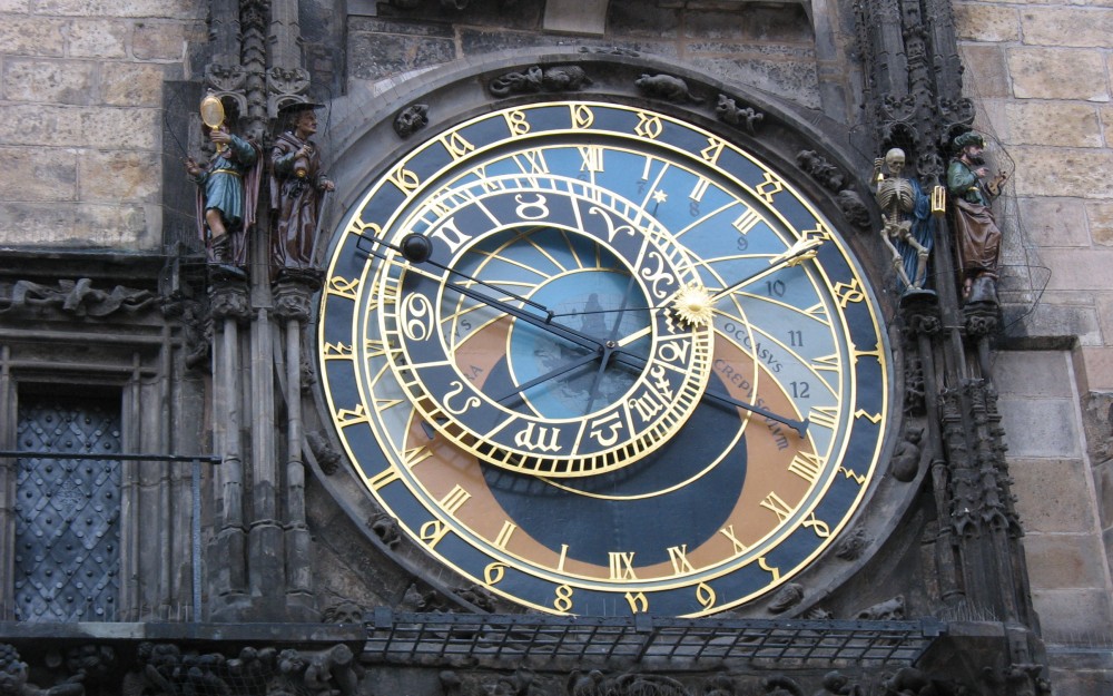
This is of course because I was leaving and the gods were Weeping…don’t believe me?  I left Prague and in case you didn’t read the papers the Bohemian Deities wept so much that the Vltava River flooded and spilled into Old Town Prague. You might point out the flooding was from rapid snow melt in the mountains in the Czech Republic along with some rainfall but then you would be leaving out a MAJOR variable in your scientific and logical analysis…it’s all about me!  HHEEEELLLOOO [why is that so hard for some people to get…jeesh]

So driving up the Glen Highway there were Cow moose and their little baby calves which always elicit an “awww” no matter how tough a guy you think you are.  The vistas were long, the skies parted and blue sky reigned once I slipped in a Road Trip collection of music from my buddy Jim.  I saw very few cars and most of them were inbound to Anchorage and they were almost all exclusively RV’s and campers.

IMG_1505

Having lived most of my life in Maine I’m pretty well-trained to scan the roadsides for Moose [in AK add caribou] who seem to move slow until they decide to walk into the road right in front of you.  Deer seem to turn and run…moose seem to want to vector right in on you and then they like to run ON the road because it’s easier going.  In Maine onetime on a dirt road a bull moose trotted in front of me for a mile or two…Watching a pair of moose testicles swinging in front of your windshield for a mile or two rapidly changes from a snicker/guffaw/snort to a “oh dear God, give me some knitting needles to stick in my eyes now!’

IMG_1511

Long stretches of road with no one in sight in either direction.  At first seeing another car elicited a “go away” response…by Day Two it felt comforting because by now I am “out there” and nothing is close.

IMG_1509

The last “town” leaving Alaska is Tok—and yes it’s pronounced as if you were doing a doobie/splif/bone.  In the gas station was this flyer for reporting Sasquatch sightings…maybe there is something to the name “Tok”.

IMG_1513

There certainly was enough smoke outside of Tok.  Numerous wildfires were burning, the smell of smoke was heavy in the air, warning signs to keep your headlights on as the road could get dark and smokey at a moments notice.  Helicopters were churning the air with their rotors flying low over the road as they dropped bucketful’s of water on the fires that ground crews could not access.

In Alaska the road was pretty good….parts of gravel that put a lot of dust in the air, road construction that had traffic backed up in some spots but mainly is was long lonely stretches of road rewarded with sweeping vistas of sharply rising mountains, rivers, glaciers, and wildlife.  Pretty cool.

IMG_1519

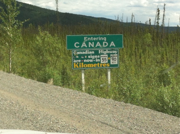
The came the Yukon…or lets be fair and say the first 20 miles of entering Canada…OH MY GOD do you hate us?!  It was the worst section of road I have ever seen that was “under construction”… potholes that could swallow my car, sections of gravel that could more accurately be called small boulders. It sucked—that’s a Department of Transportation official term by the way.

IMG_1520

At one section I was down to 20 mph following some RV’s. Normally I would have wanted to launch a shoulder-fired missile and cackle like a mad scientist as it blew skyward but in this case when they would do a BIG BOUNCE I knew something was up and could crawl through the section.  Did I mentioned that it SUCKED?

Once I hit the border station which actually lies 20 miles INSIDE Canada right at Beaver Creek ,where I stayed for the night, the road got a little better.  It was a much longer day than I expected…9 hours when it should have been 7 at the most…assuming good roads…

Beaver Creek, Yukon.  Canada Day [their 4th of July].  Apparently I missed the parade in the morning and the person checking me in just gave me a blank stare when I asked if we could do it again tonight.  You know. For me. [Please see paragraph three for a reminder].

IMG_1522

I looked at the front of my car and t looked like a scene from a horror movie…seems like some of those beautiful dragonflies in their swarms along the highway didn’t all make the slipstream of the car. I like dragonflies, they eat mosquitoes. I felt bad.

IMG_1524

Beaver Creek is wwaaayyy out there and other than being a border town and catering to those traveling the Alaska Highway there isn’t much there.  However the Westmark Tok hotel had a “Follies” they put on every night in the summer [big doings!] so there was a bus tour enjoying that which also seemed to employ the entire town.

IMG_1523

Including one of the Mounties at the RCMP station, Officer Friendly.  He was friendly and I got some temporary Maple Leaf tattoos. There has been much speculation amongst my kids as to where I put the tattoo [any tattoo for that matter-I love Canada]

IMG_0047 Day 2. July 2.

On the road O’dark early for a relatively short day—6 hours of driving–to Whitehorse, capital of the Yukon. Saw a Brown bear foraging so that made getting an early start worth while.

The roads were still lousy though not as bad as the first 20 miles.  The ALCAN was built on permafrost and as those areas of the road thaw and re-freeze instead of the “frost heaves” we would get in Maine the road would undulate with troughs and crests. Some were intense and could launch you, others you felt yourself drop into…no going more than 50mph so you could brake in time for the really bad ones.

I learned that when I was going over some of the muskeg type lowlands with their stunted spruce the undulation would be more pronounced.  When they cut the road into the sides of mountains the road was less susceptible to vagaries of the permafrost undulations.  I’m learning.

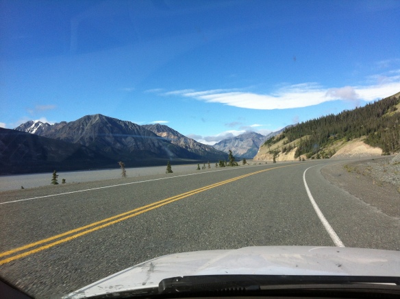
South of Burwash Landing not only were the views amazing, along with the $6++ dollar gallon of gas, the road dramatically improved.  Better than in Alaska…in fact it was fantastic and my little Audi A6 put her back into it.

IMG_1526 IMG_1528

Whitehorse fell right into place.  Located on the shores of the rapidly flowing Yukon River Whitehorse is the capital city for the Yukon and seat of Government.  The famous Klondike Gold Rush of 1896-1899 put Whitehorse really on the map though the natives had been coming to the area for countless generations as part of their nomadic cycle

From Wikipedia:

The Klondike Gold Rush, also called the Yukon Gold Rush, the Alaska Gold Rush, the Alaska-Yukon Gold Rush and the Last Great Gold Rush, was a migration by an estimated 100,000 prospectors to the Klondike region of the Yukon in north-western Canada between 1896 and 1899.

Klondike

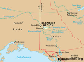
Gold was discovered here on August 16, 1896 and, when news reached Seattle and San Francisco the following year, it triggered a “stampede” of would-be prospectors. The journey proved too hard to many and only between 30,000 and 40,000 managed to arrive. Some became wealthy; however, the majority went in vain and only around 4,000 struck gold. The Klondike Gold Rush ended in 1899 after gold was discovered in Nome, prompting an exodus from the Klondike.

ChilkootPass_steps

Whitehorse is a modern town/city with all the services you could want…including gas at least in the $5 dollar range…

IMG_1534 IMG_1533 IMG_1531

It is said that if you “pee” in the Yukon you are no longer “Cheechako”.  I am sure the good citizens of Whitehorse have laws against any sort of public urination and I support them.  I am, however, no longer Cheechako.

enough for now…next two days will be long with tomorrow at Liard Hot Springs Lodge and then the following day in Fort Saint John…

The Beginning of the End…a series

All good things must come to an end. As the final chapter of my Fulbright in the Czech Republic, re-entry back to the US, and starting a new chapter in life I’ll be doing a “Postcards from the Road” series as I drive approximately 4,600 miles [~7,300 kilometers] from Anchorage, Alaska to New Hampshire/Maine.

I’ll be traveling the legendary ALCAN [Alaska-Canada] highway:

the-alaska-highway0

as part of the Long Road Home:

Screen Shot 2013-06-27 at 7.05.22 PMThe ALCAN was born out of fear.

While the idea of a road connecting Alaska with the Lower 48 had been floated since the 1920’s [first as a dog sled route…] it was the invasion of Pearl Harbor that spurred the Americans and the Canadians to action.  They feared the Japanese may invade Alaska…and they were right.

Many Americans think that US soil was never invaded by the Japanese during World War II but that isn’t true.  The Japanese began by bombing Dutch Harbor on the island of Unalaska on June 3rd and 4th, 1942 [you may know it as the harbor featured in the reality show The Deadliest Catch] killing 78 US Servicemen.

bombing_dutch_copy_1

Following that attack the Japanese invaded and occupied the islands of Kiska and Attu on June 6th and 7th, 1942.  90 Americans were taken prisoner from those islands.

Aleutians_Map

While the ALCAN was authorized in February of 1942 the attacks and invasion by the Japanese of the Aleutian islands spurred the construction into overdrive as there were no roads into Alaska to defend it.

For some context and perspective here’s an edited piece on the history of the ALCAN from Wikipedia.

“The Alaska Highway (also known as the Alaskan Highway, Alaska-Canadian Highway, or ALCAN Highway) was constructed during World War II for the purpose of connecting the contiguous U.S. to Alaska through Canada. It begins at the junction with several Canadian highways in Dawson Creek, British Columbia, and runs to Delta Junction, Alaska, via Whitehorse, Yukon.

Completed in 1942 at a length of approximately 2,700 kilometers (1,700 mi), as of 2012 it was 2,232 km or 1,387 mi long. The difference in distance is due to constant reconstruction of the highway, which has rerouted and straightened out numerous sections. The highway was opened to the public in 1948. Legendary over many decades for being a rough, challenging drive, the highway is now paved over its entire length.

An informal system of historic mileposts developed over the years to denote major stopping points; Delta Junction, at the end of the highway, makes reference to its location at “Historic Milepost 1422.”It is at this point that the Alaska Highway meets the Richardson Highway, which continues 155 km (96 mi) to Fairbanks. This is often regarded, though unofficially, as the northern portion of the Alaska Highway, with Fairbanks at Historic Milepost 1520. Mileposts on this stretch of highway are measured from Valdez, rather than the Alaska Highway. The Alaska Highway is popularly (but unofficially) considered part of the Pan-American Highway, which extends south (despite its discontinuity in Panama) to Argentina.

Proposals for a highway to Alaska originated in the 1920s. Thomas MacDonald, director of the U.S. Bureau of Public Roads, dreamed of an international highway spanning the United States and Canada. In order to promote the highway it was originally a proposed route by dog sled. Since much of the route would pass through Canada, support from the Canadian government was crucial. However, the Canadian government perceived no value in putting up the required funds to build the road, since the only part of Canada that would benefit was not more than a few thousand people in the Yukon.

The attack on Pearl Harbor and beginning of the Pacific Theatre in World War II, coupled with Japanese threats to the west coast of North America and the Aleutian Islands, changed the priorities for both nations. On February 6, 1942 the construction of the Alaska Highway was approved by the United States Army and the project received the authorization from the U.S. Congress and President Franklin D. Roosevelt to proceed five days later. Canada agreed to allow construction as long as the United States bore the full cost, and that the road and other facilities in Canada be turned over to Canadian authority after the war ended.

The official start of construction took place on March 8, 1942 after hundreds of pieces of construction equipment were moved on priority trains by the Northern Alberta Railways to the northeastern part of British Columbia near Mile 0 at Dawson Creek. Construction accelerated through the spring as the winter weather faded away and crews were able to work from both the northern and southern ends; they were spurred on after reports of the Japanese invasion of Kiska Island and Attu Island in the Aleutians. During construction the road was nicknamed the “oil can highway” by the work crews due to the large number of discarded oil cans and fuel drums that marked the road’s progress.

On September 24, 1942 crews from both directions met at Mile 588 at what became named Contact Creek, at the British Columbia-Yukon border at the 60th Parallel; the entire route was completed October 28, 1942 with the northern linkup at Mile 1202, Beaver Creek, and the highway was dedicated on November 20, 1942 at Soldiers Summit.

Although it was completed on October 28, 1942 and its completion was celebrated at Soldier’s Summit on November 21 (and broadcast by radio, the exact outdoor temperature censored due to wartime concerns), the “highway” was not usable by general vehicles until 1943. Even then there were many steep grades, a poor surface, switchbacks to gain and descend hills, and few guardrails. The easing of the Japanese invasion threat resulted in no more contracts being given to private contractors for upgrading of specific sections.

The original agreement between Canada and the United States regarding construction of the highway stipulated that its Canadian portion be turned over to Canada six months after the end of the war. This took place on April 1, 1946 when the US Army transferred control of the road through the Yukon and British Columbia to the Canadian Army, Northwest Highway System. The Alaskan section was completely paved during the 1960s; largely gravel even in 1981, the Canadian portion of the Alaska Highway is now completely paved.”  

See you from The Road!